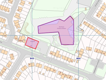
Digimap for Schools is a great tool that's quick and easy to use, whether it's for making resources for lessons or getting students to map out their DofE route.
Digimap for Schools and our free learning resources provide a wealth of creativity for primary age children. Ideal for young minds discovering about their environment and an ideal backcloth for discussing topical events - local and global.
What you can teach
Locational Knowledge
-
Use Digimap to name and locate the world`s seven continents and five oceans, including polar and desert regions.
-
Teach learners to name, locate and identify characteristics of the four countries and capital cities of the United Kingdom and its surrounding seas.
Place Knowledge
-
Use Digimap to teach your learners how to understand geographical similarities and differences through studying the geography of any area of the United Kingdom, and any contrasting area in the countries of the world.
-
Use Digimap to teach about grid references - British National Grid and Latitude/Longitude.
Human and physical geography
-
Use Digimap to teach about the Equator and the North and South Poles, identify hot and cold areas of the world in relation to it.
-
Add climate information to the maps to support your teaching of the environment.
-
Show examples of geographical features such as: beach, coast, forest, hill, mountain, sea, ocean, river, and valley.
-
Show examples of human features such as: city, town, village, factory, farm, house, office, port, harbour and shop.
-
Describe and understand climate zones, time zones, biomes, rainfall, population density and many more.
Geographical skills and fieldwork
-
Use Digimap`s global maps to identify the United Kingdom and its countries, as well as any other country, continent and ocean studied at this level.
-
Teach the compass directions and its 8 points, 4- and 6- figure grid references and locational and directional language such as ‘near’ and ‘far’, ‘left’ and ‘right’, to describe features and routes on a map. Build knowledge of the United Kingdom and the wider world.
-
Digimap`s fantastic aerial photographs helps learners plan perspectives and to recognise landmarks and basic human and physical features.
-
Print a map of your choice, for your needs, to support field work, upload data in the classroom to overlay on a map on thescreen.
-
Annotate your maps to tell a story by adding pictures or graphs to support creative, engaging and interactive teaching andlearning.
Numeracy
-
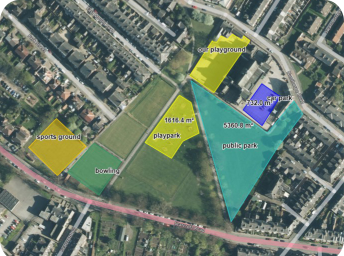
Measure distances and areas of places learners know – their walk to school or their favourite park.
-
Convert measurement units.
-
Understand the concept of varying radius by plotting concentric circles.
Literacy
-
Look at place names, discuss how and why they have come about.
-
Consider the settings for novels or poetry.
History
-
Compare and contrast beautiful hand-drawn maps from the 1890s with today – consider what their local town looked like at the end of the Victorian era.
-
Consider post war mapping of 1950s Great Britain – see the growth of new towns.
Outdoor Learning
-
Plot your Duke of Edinburgh or cross-country course.
-
Investigate the location for your school residential (or overseas) trip.


One login, accessible from anywhere on any supported device. Unlimited use at school and home for students, teachers and parents.
Get started

