User manual
Capture geographic coordinates
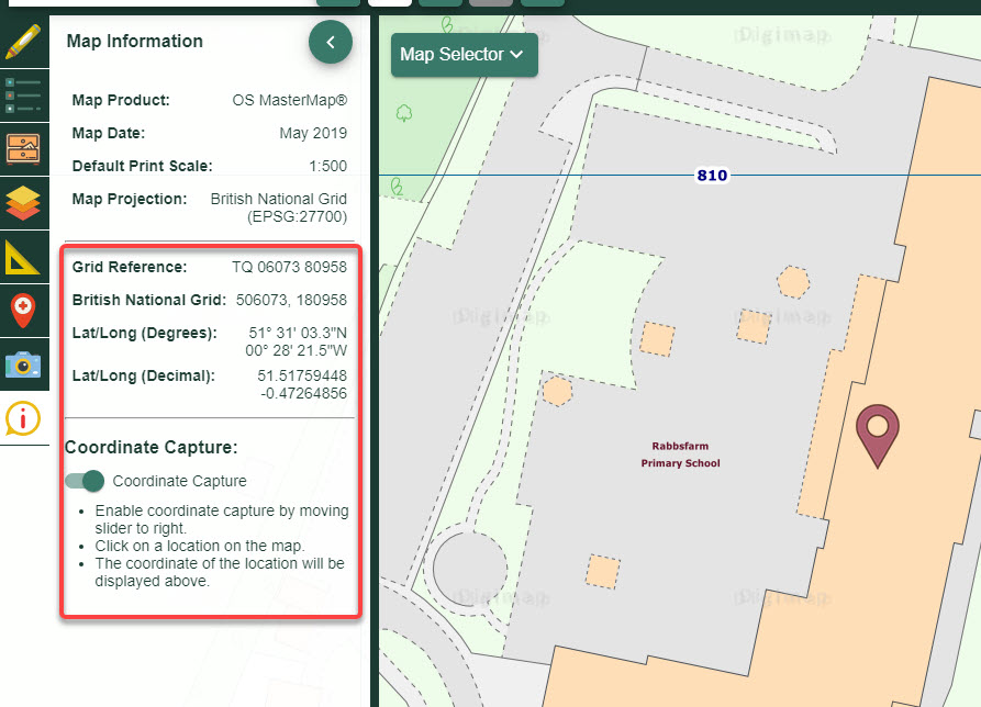
To find the coordinates for any point:
- Open Map Information in the sidebar.
- Select the Coordinate Capture button, see image below.
- Select any point in the map window.
- Coordinates of your point are displayed in the Map Information area, in this order: 1. British National Grid Reference (only when over Great Britain) 2. Easting, Northing (only when over Great Britain) 3. Latitude and longitude degrees 4. Latitude and Longitude decimal degrees
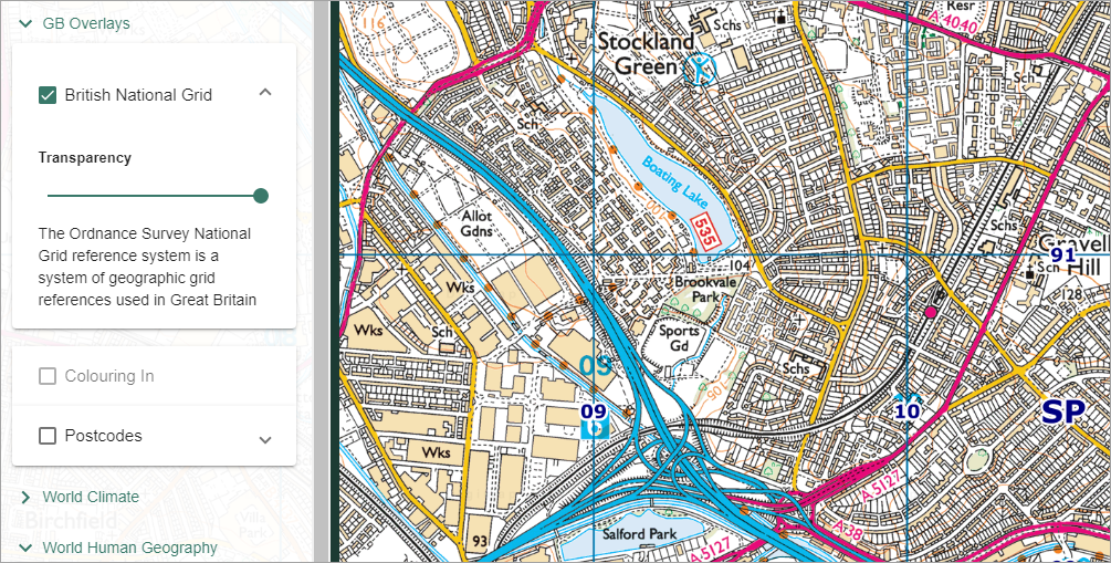
To display British National Grid lines:
- Open the Overlays menu in the sidebar.
- Check the British National Grid box. NOTE: only available over Great Britain.
- Grid lines are displayed in the map window.
- Adjust the transparency of the grid lines by moving the transparency slider left and right.
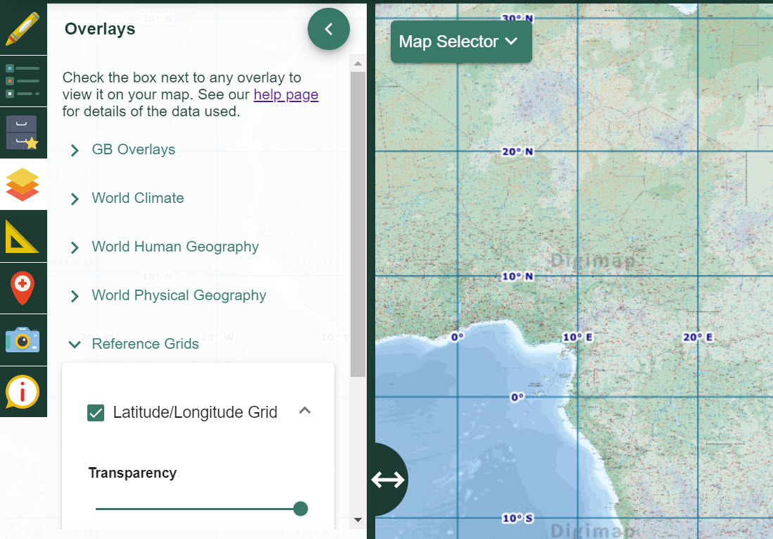
Latitude and Longitude
- Open the Overlays menu in the sidebar.
- Select Reference Grids.
- Check the Latitude/Longitude Grid box.
- The grid lines are displayed.
- Adjust the transparency of the lines by moving the transparency slider left and right.