

User manual
Map information
To find information on maps, we have two tools:
- Map Information in the sidebar
- the Aerial Imagery information tool in the top toolbar.
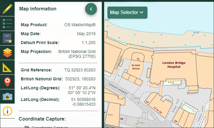
What’s the name of the map I am viewing?
- Open Map Information in the sidebar.
- The name of the map is detailed in the Map Product field.
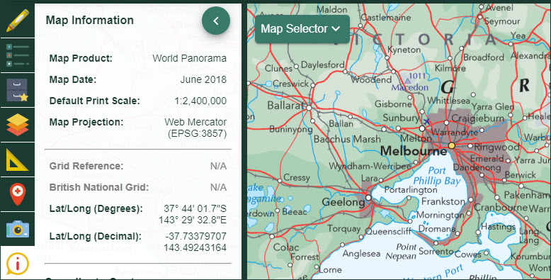
What’s the date of the map I am viewing?
- Open Map Information in the sidebar.
- The date of publication for the map is detailed in the Map Date field (see image below).
- NOTE: this does not apply to historical maps - see note below.
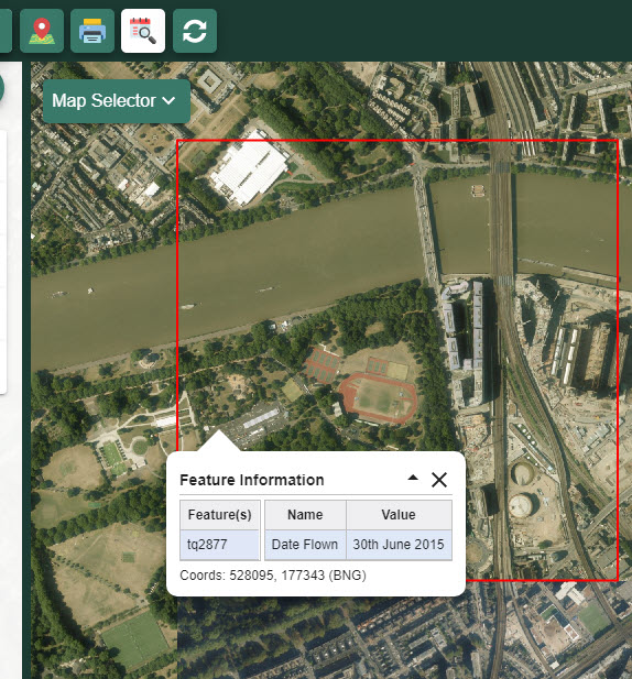
What about aerial photography?
- Select the Aerial Imagery tool from the top toolbar (see image below).
- Select the point of interest on the map window.
- A box is generated that gives:
- the grid reference of the aerial photo
- the date the image was taken
When were the historical maps created?
We don’t have survey or publication dates for specific areas for the historical maps. The 1890s and 1950s were selected for inclusion as they offered the best coverage of Great Britain.